Municipal roadways

AI Roadway Defect Detection

We have developed, deployed, and validated computer vision models designed to detect and assess roadway defects in real operating environments. Vehicle-mounted imaging, edge processing, and geolocation transform routine municipal fleet routes into reviewable, mapped evidence that helps public works teams prioritize maintenance and plan repairs.

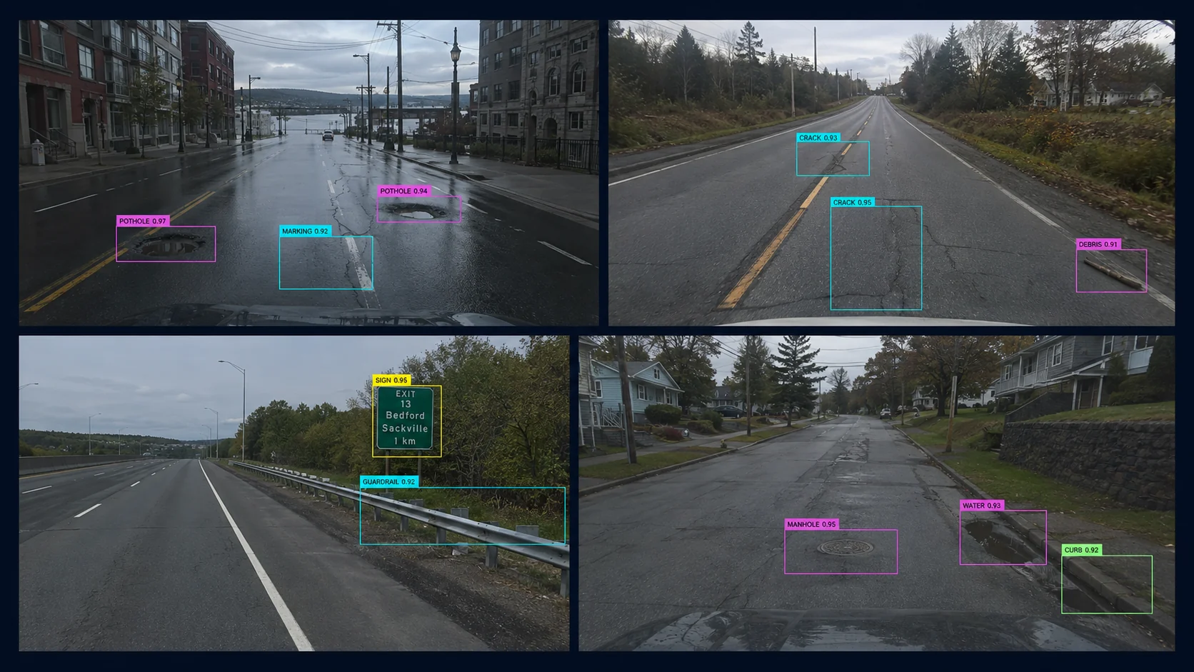
Multiple roadway video feeds with rectangular AI detection boxes

01 / FIELD DETECTION

Detect, measure, and validate roadway defects.

Use computer vision to identify potholes, cracking, shoulder and curb deficiencies, and damaged roadside assets. Preserve geolocated images and estimated dimensions so staff can validate each detection, assign severity, and resolve duplicate observations.
PotholesLinear crackingShoulder defectsCurb and gutterGuiderailsManholes
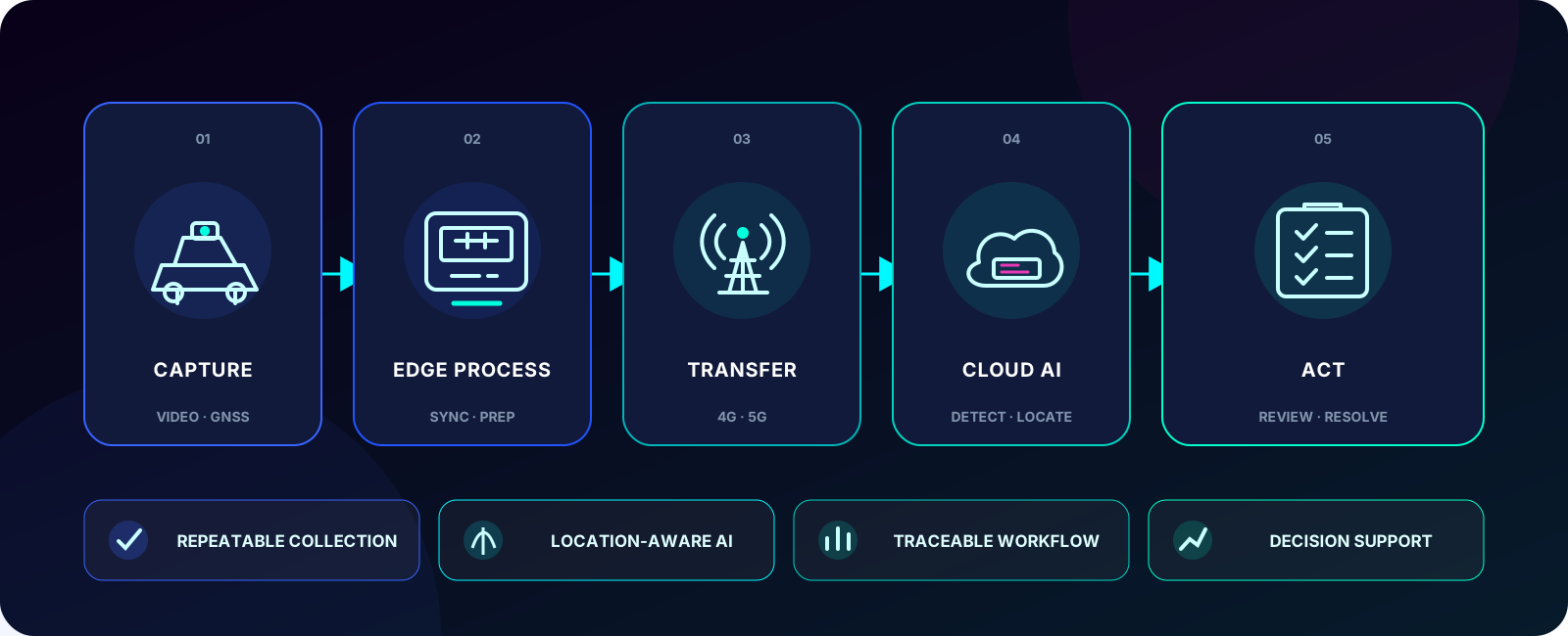
Municipal roadway inspection workflow from vehicle capture and edge processing to human validation and work-order follow-up
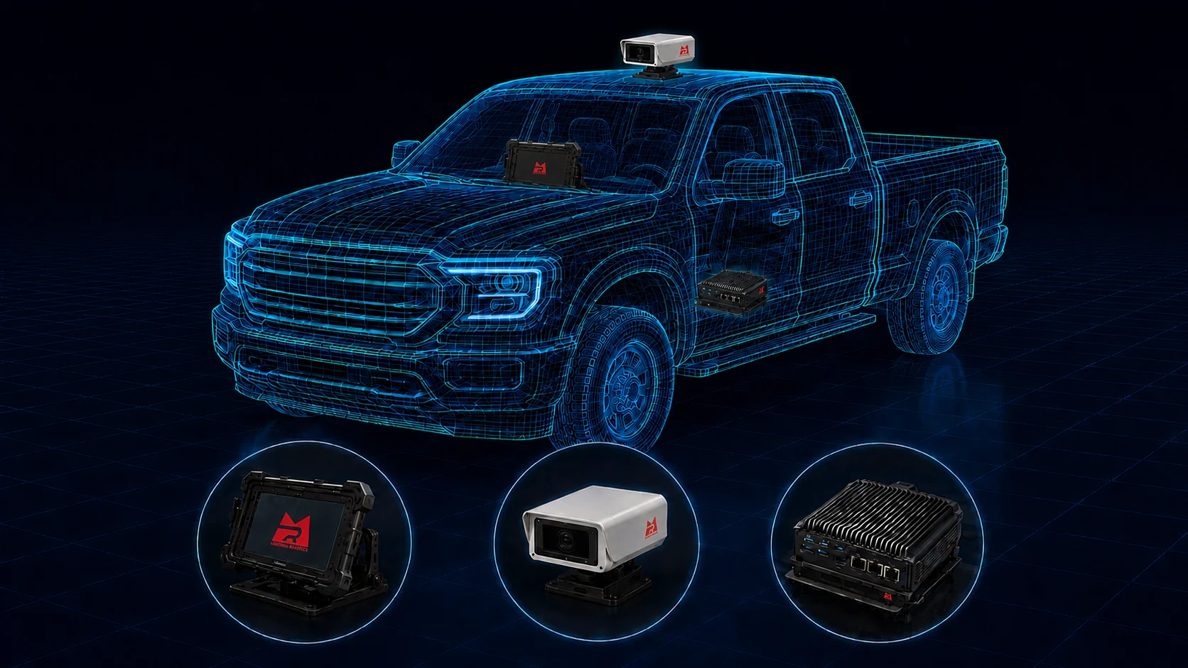
Pickup-mounted Road AI camera, in-cabin tablet and edge computer

02 / VEHICLE KIT

Capture roadway evidence from the municipal fleet.

A road-facing camera, edge computer, and GNSS-enabled location record bring repeatable inspections into vehicles already used for patrol and maintenance. Encrypted offline buffering keeps collection running when cellular coverage is limited.

  • Road-facing image capture while vehicles are in motion
  • Edge AI processing and encrypted store-and-forward
  • GNSS-linked evidence, measurements, and route records

03 / INSPECTION PLATFORM

Move validated defects into municipal workflows.

The platform is designed for desktop and mobile review of maps, imagery, measurements, severity, and incident history. Human approval controls what moves into GIS and municipal work-order systems such as Cityworks, with reports and audit records for every step.